

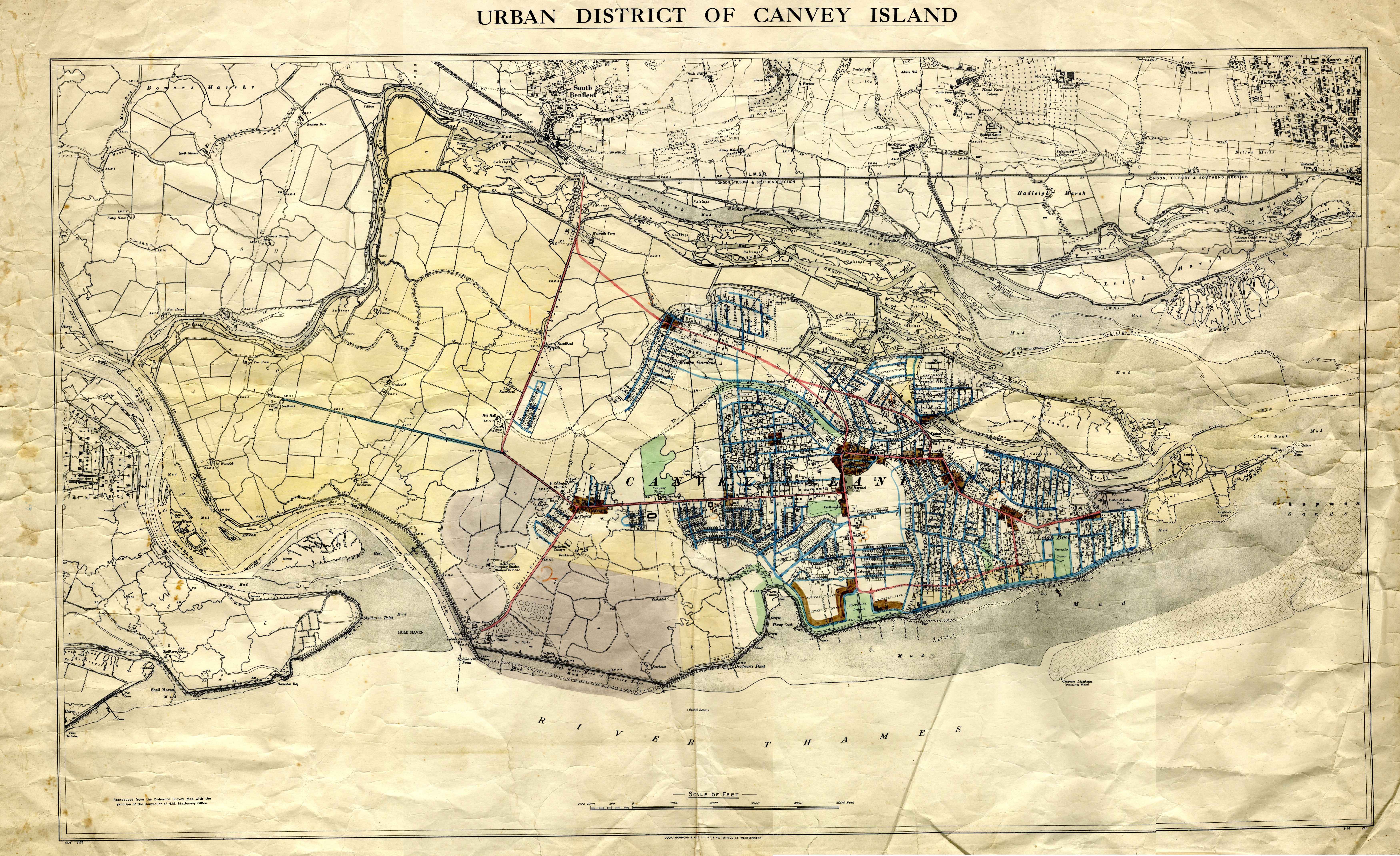
This map is from A.M. Clark Estate’s papers donated by the Squire Family and courtesy of the Heritage Centre.
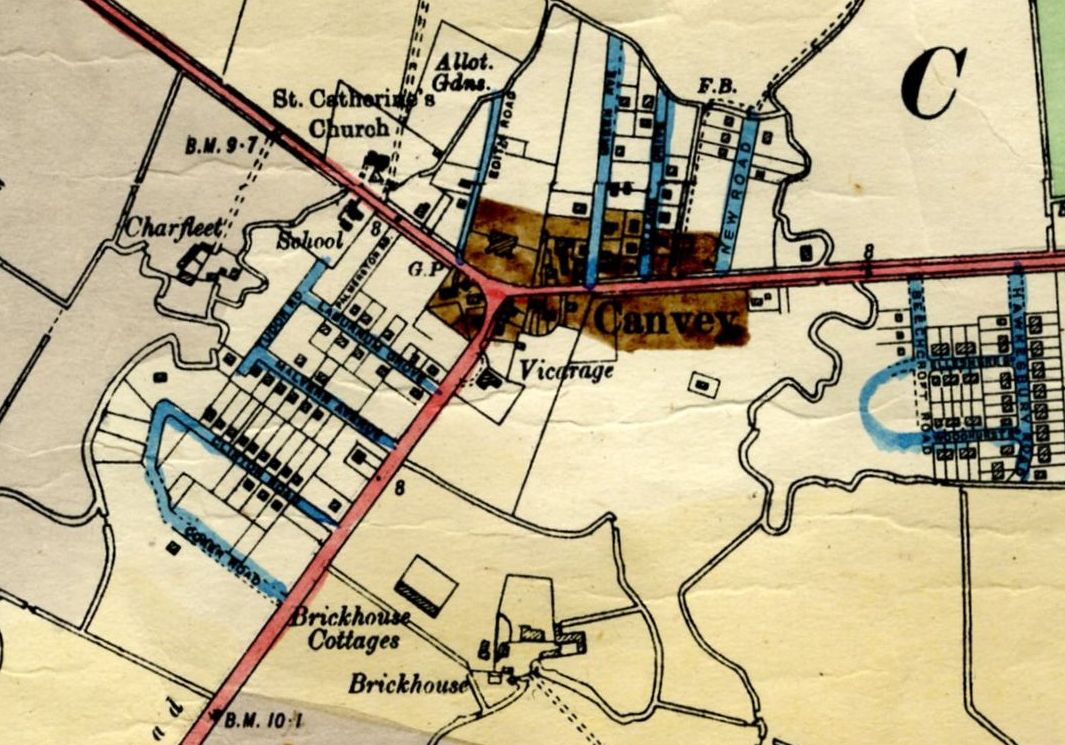
It is undated but appears to be a working map, by this I mean additional roads etc have been added showing possible future construction. It is believed the map dates from the late 1930s. We know the Dutch Village was being constructed about this time and the three replica Dutch houses East of the Village and the newly built tanks near the Coastguard cottages are shown too. Plus if you look very closely at the village you will see the old Red Cow has gone and the newly built Red Cow that is set back from the road can be seen. Just noticed the bridge too. The more I look the more I see. I will upload some close-ups of some areas shortly.
If you click on the map you can see an enlargement.


No Comments
Add a comment about this page