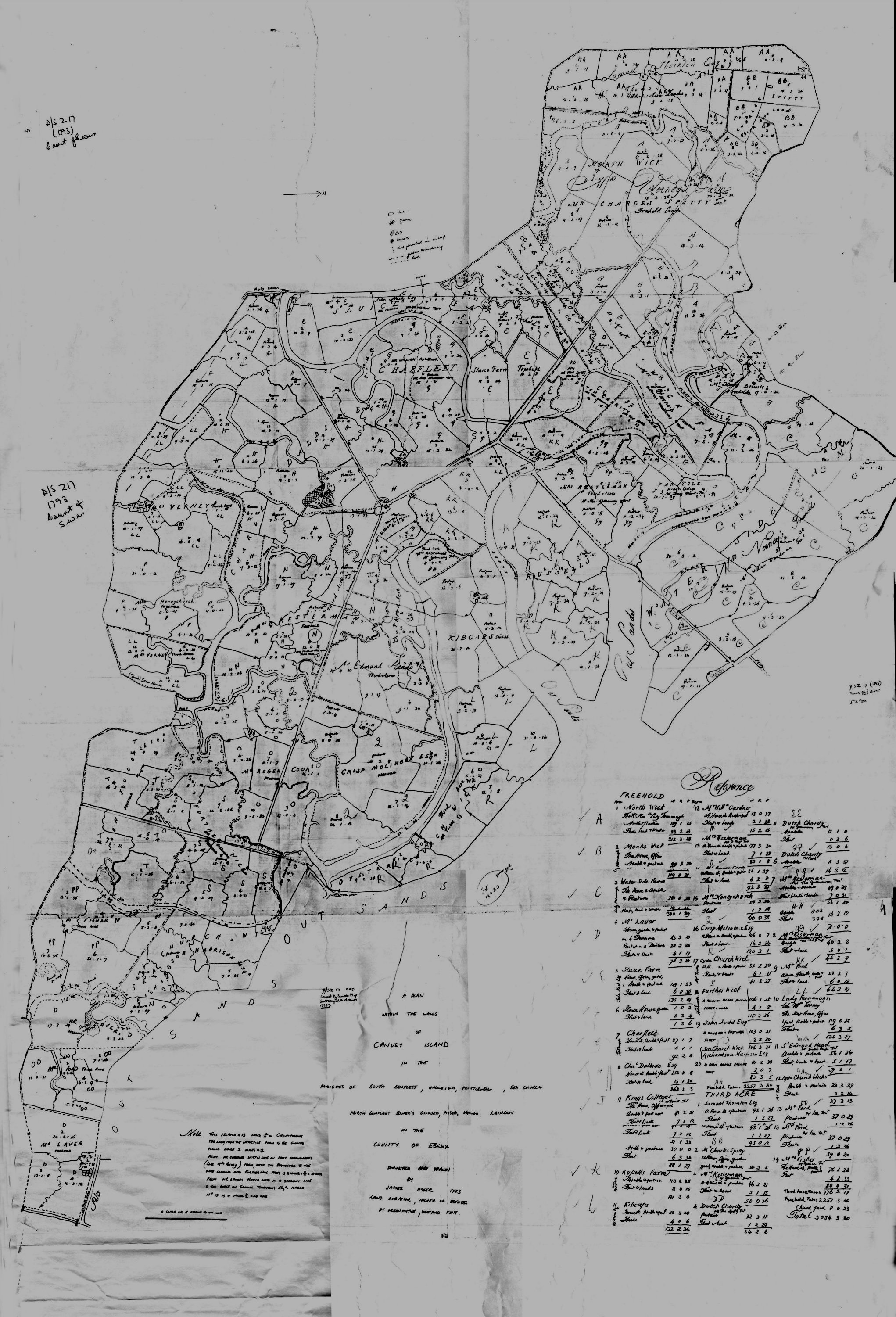
This map dated 1793 still shows Dutch landowners, the Dutch Charity, on some of the Third Acre land. Look for DD, EE, and FF on the map.
Author
By Janet Penn
Page added
02/12/2017
Comments about this page
In 1910, the “Dutch Charity” land was still known as that name. Owned by a Wm. PEASE. Purchased in 1893 for £270, and further expending £5. The actual or estimated annual rent in 1910 was £60.
The extent of the land appears to have been changed on the Tax Evaluation book from 49ac, 1n, 15pls to 51a, 0n, 13pls.
It was described as 5 pasture meadows (no buildings except a small boarded & thatched shed).
By Martin Lepley (03/12/2017)
No not changed much there were three areas owned by the Dutch Charity. Marked as DD, EE and FF. DD is not shown on the enlargement.


Comments about this page
In 1910, the “Dutch Charity” land was still known as that name. Owned by a Wm. PEASE. Purchased in 1893 for £270, and further expending £5. The actual or estimated annual rent in 1910 was £60.
The extent of the land appears to have been changed on the Tax Evaluation book from 49ac, 1n, 15pls to 51a, 0n, 13pls.
It was described as 5 pasture meadows (no buildings except a small boarded & thatched shed).
No not changed much there were three areas owned by the Dutch Charity. Marked as DD, EE and FF. DD is not shown on the enlargement.
Add a comment about this page