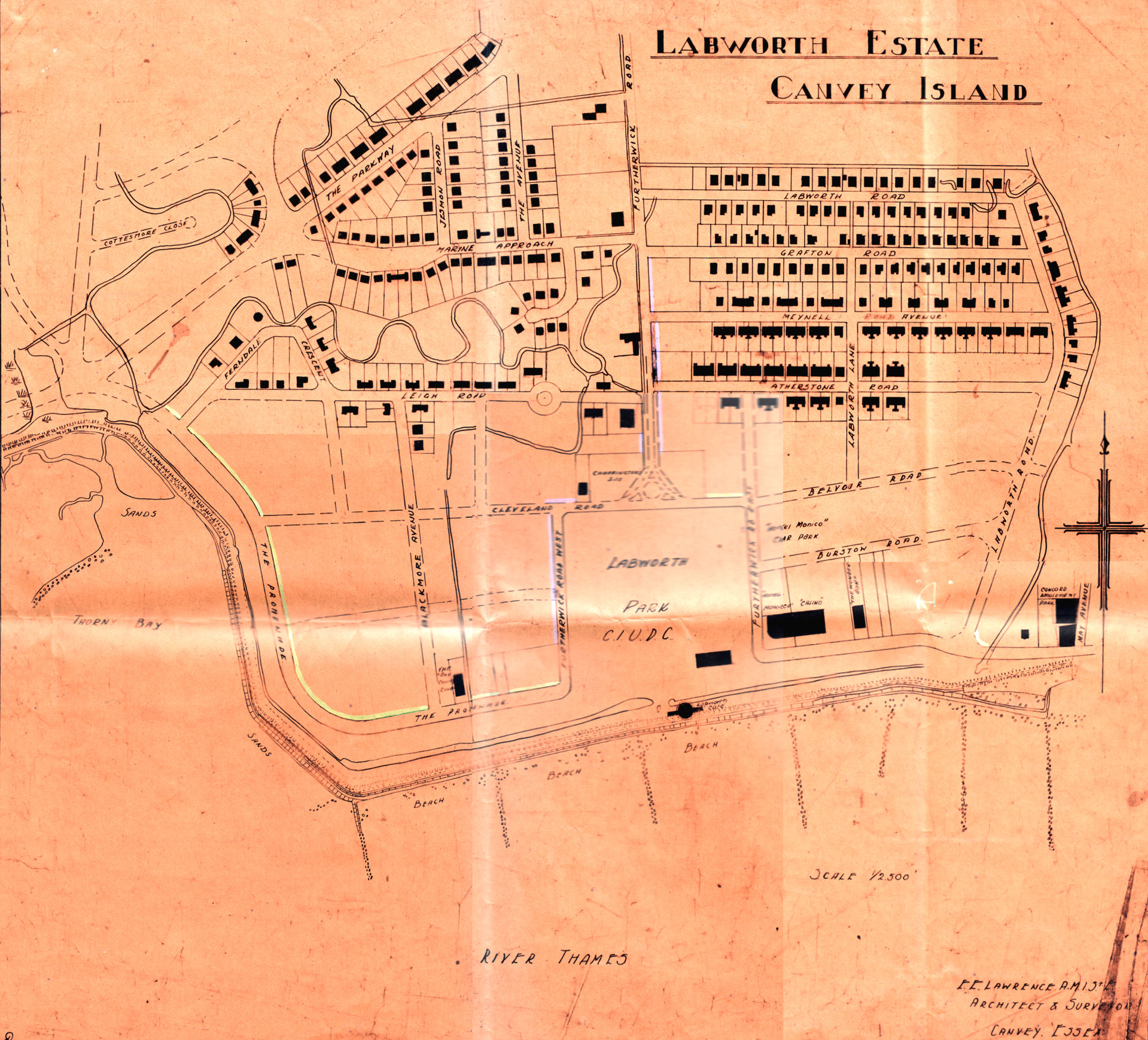
Map of Labworth Park Estate
Drawn by E.E.Lawrence late 1930s/40s

Click to see enlargement

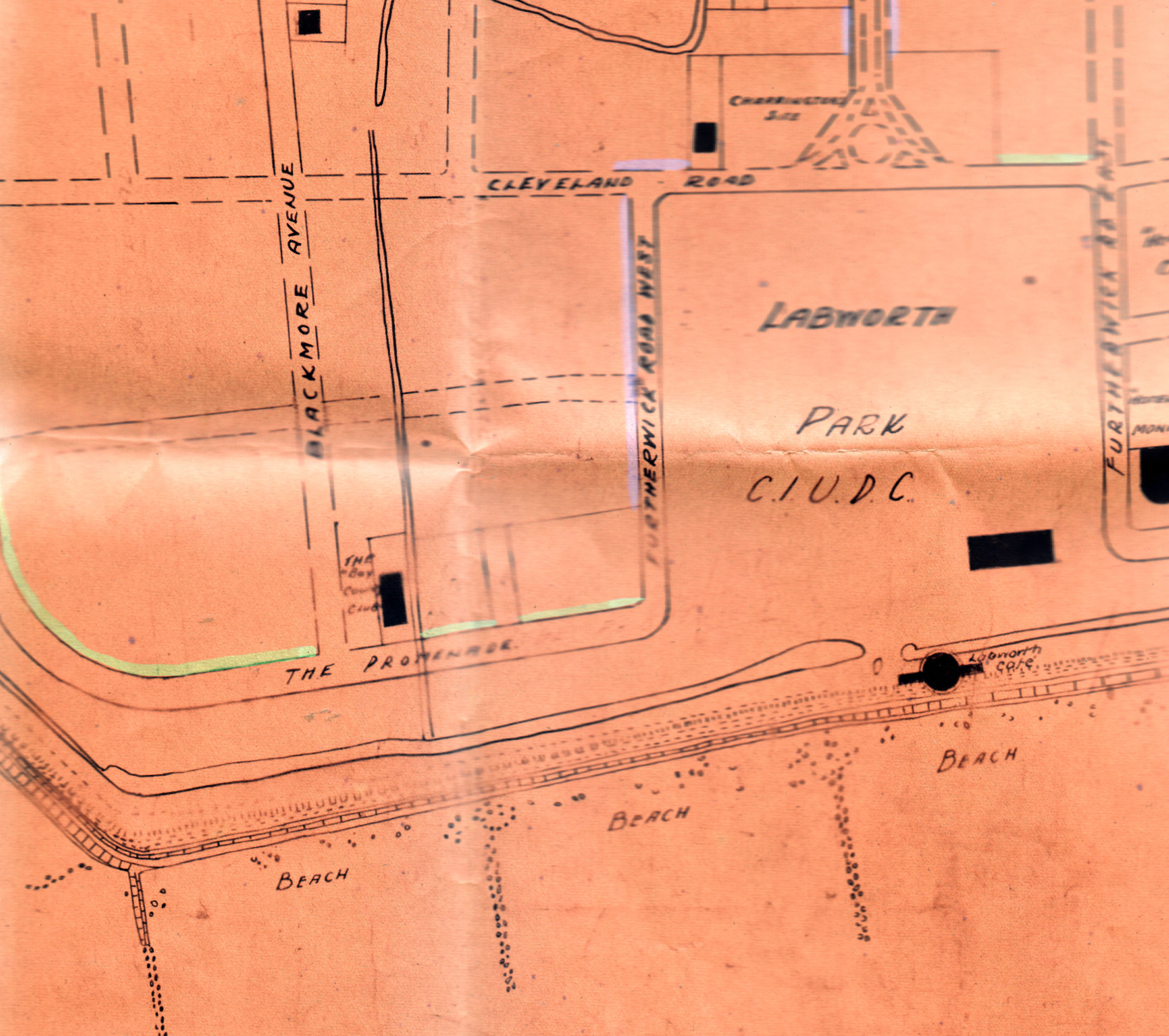
Not the Monico Hotel, Casino and The Wonder Bar

To the West is the Bay Country Club and to the East is the very distinctive shape of the Labworth Cafe

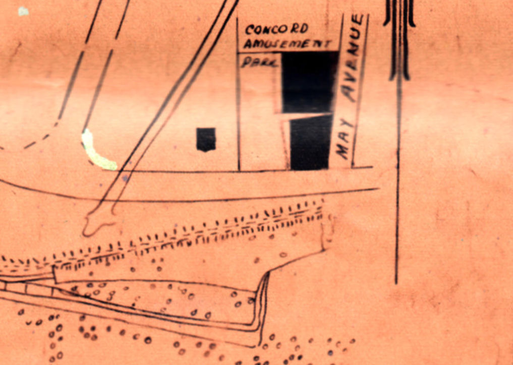
In this part of the map you can see the tidal pool. Just to the north is a small black square that was Concord House and to the east at the bottom of May Avenue is Concord Amusement Park.


Comments about this page
Great map, and my best one for confirming childhood memories of Canvey. During WW11 I lived at 118, The Parkway, but was surprised not to see The Driveway, which ran parallel to and N. of the Parkway!!
We then lived at 1 Marine Approach which is clearly shown, and left for Canada from there. I enjoyed pin pointing many of my wartime memories including the burning B17 roaring overhead, the full length of The Parkway, Driveway towards it’s final crash location at The Point!!
Add a comment about this page