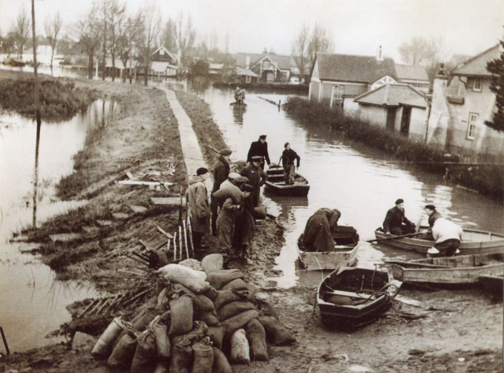
The top photo is the counter-wall looking towards the junction of Dovervelt, Nevada and Hindles Roads. The sandbags are piled on the slope which joined Rainbow Rd to the Newlands area. It would appear that at this early stage of the operation because of the depth of water in Newlands the only available means of conveying the sandbags to the non-existent Tewkes Creek wall(subject of bottom photo) was a fleet of rowing boats.
By Graham Stevens (28/01/2013)
At the time of the Flood I was working as an apprentice with The North Thames Gas Co.and had decided to stay on the Island even though my family had evecuated to the Mainland. Of course, it was impossible to carry out my usual work assignments and spent most of Feb 1st on rescue work in a rowboat, along some of the worst flooded roads in the Rainbow Rd. area. Following that I was sent to assist with drainage of the Island, some of which occurred as shown in the top photo where a breach was cleared and temporarily deepened at low tide to permit drainage. On my first day of work at that effort, I have the terrible memory of seeing one deceased person, lying close to the wall at the point where I would begin walking towards that drainage work area.!! Those were difficult and very sad times.
By Gerald Hudson (28/01/2013)
The second picture is where the main breach occurred at bottom of Heilsburg and Tewkes Rd, TEWKES CREEK.


Comments about this page
The top photo is the counter-wall looking towards the junction of Dovervelt, Nevada and Hindles Roads. The sandbags are piled on the slope which joined Rainbow Rd to the Newlands area. It would appear that at this early stage of the operation because of the depth of water in Newlands the only available means of conveying the sandbags to the non-existent Tewkes Creek wall(subject of bottom photo) was a fleet of rowing boats.
At the time of the Flood I was working as an apprentice with The North Thames Gas Co.and had decided to stay on the Island even though my family had evecuated to the Mainland. Of course, it was impossible to carry out my usual work assignments and spent most of Feb 1st on rescue work in a rowboat, along some of the worst flooded roads in the Rainbow Rd. area. Following that I was sent to assist with drainage of the Island, some of which occurred as shown in the top photo where a breach was cleared and temporarily deepened at low tide to permit drainage. On my first day of work at that effort, I have the terrible memory of seeing one deceased person, lying close to the wall at the point where I would begin walking towards that drainage work area.!! Those were difficult and very sad times.
The second picture is where the main breach occurred at bottom of Heilsburg and Tewkes Rd, TEWKES CREEK.
Add a comment about this page