

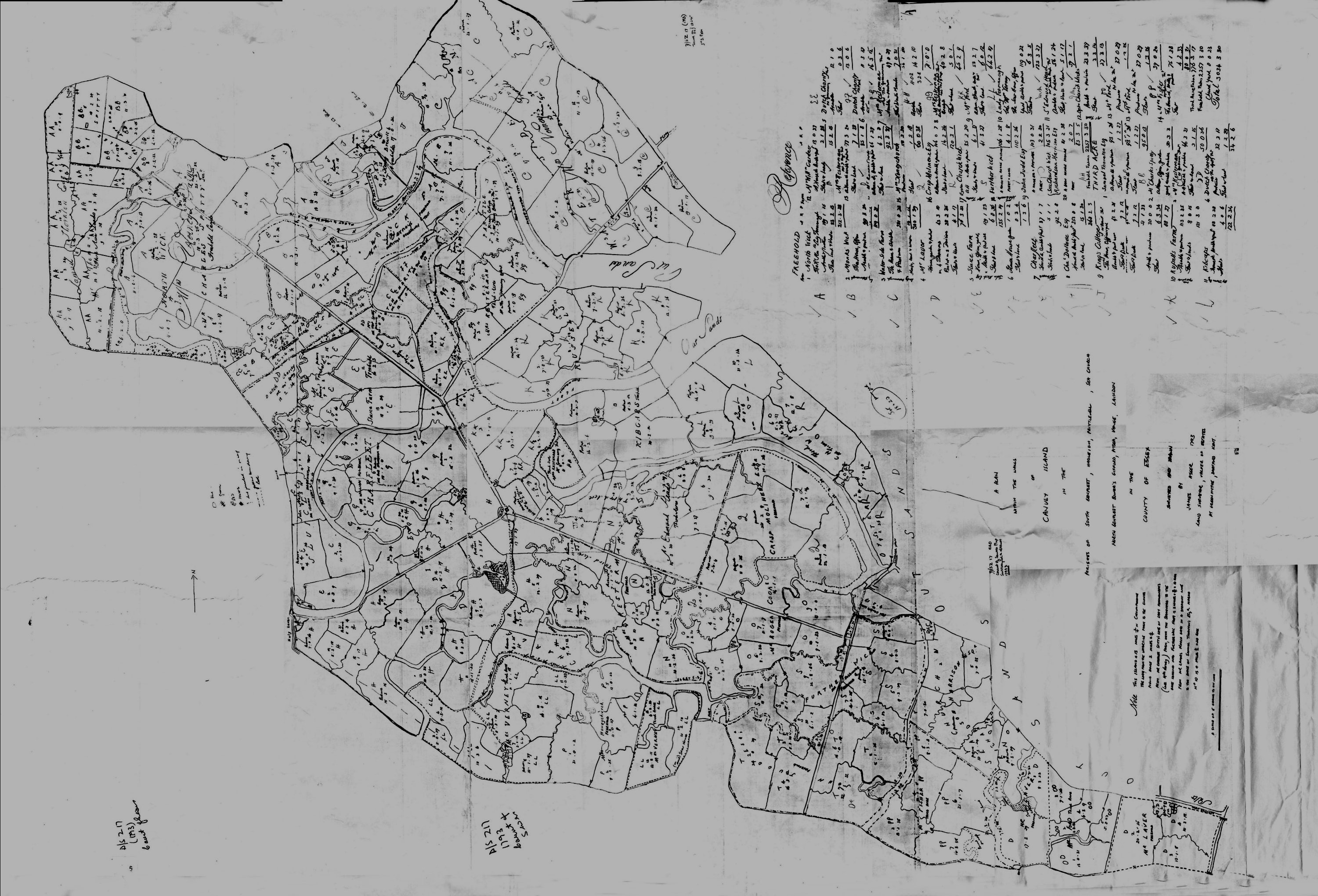
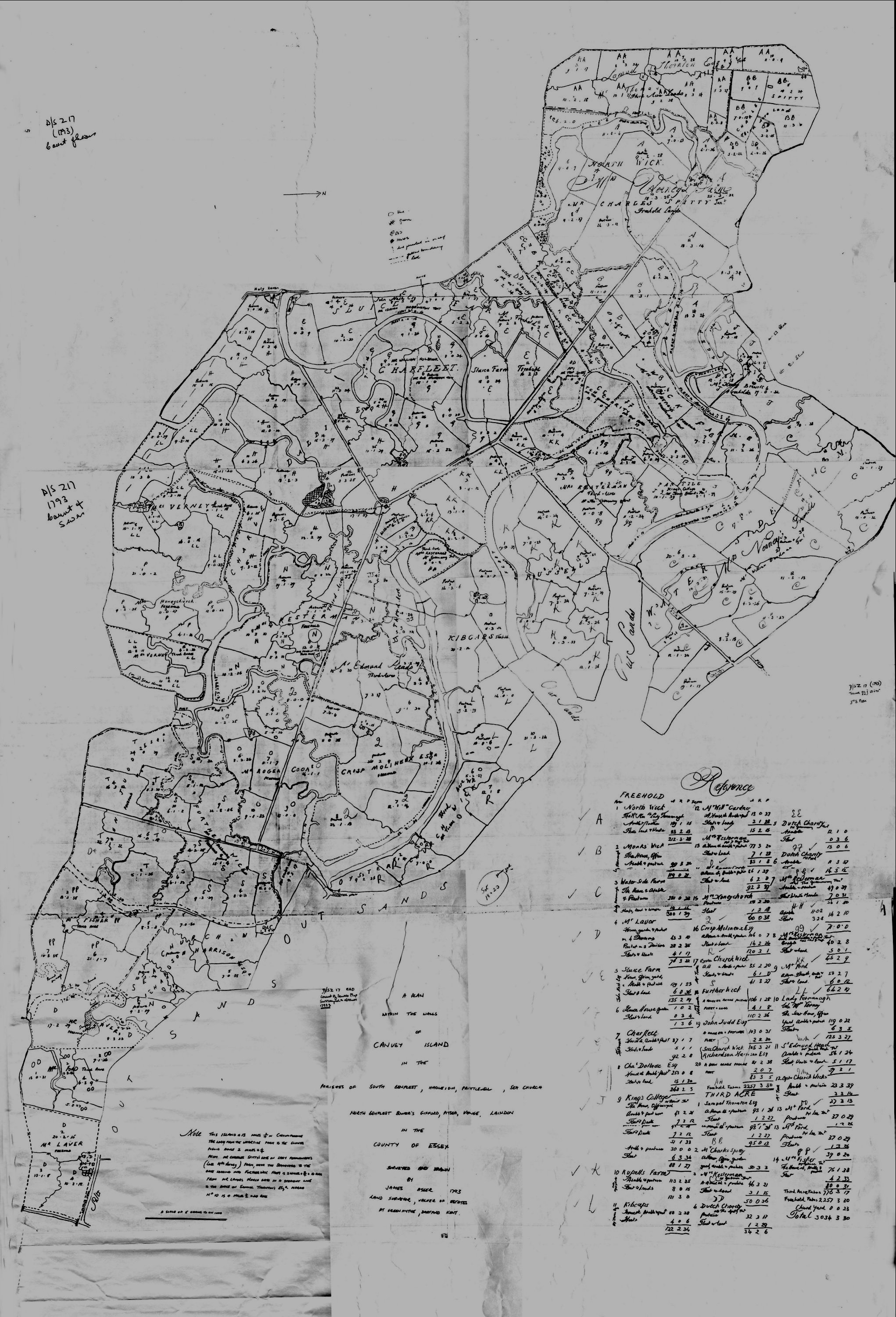
This map was kindly lent to me by Janet Dolling. It is dated 1793 and shows not only the farms but the pastures and acreage and most important the landowners. I have put up two copies of the map because if you look at the bottom map this is the correct way up to read the writing but for purposes of getting ones bearings I thought you would like to see a copy as you would recognise it.
Click on the maps to see enlargements


No Comments
Add a comment about this page