The Building of Somnes Avenue
Photos by Eddie Newman
These photos were lent to us by Sylvia Brown whose Uncle Eddie Newman was a keen photographer. Unfortunately he lost his early photos in the floods.
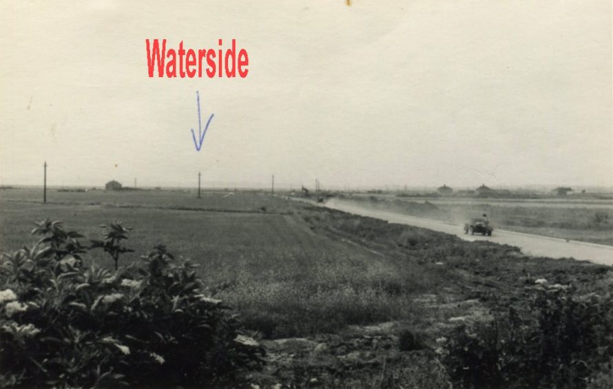
Looking West towards where Waterside Sports Centre is now situated
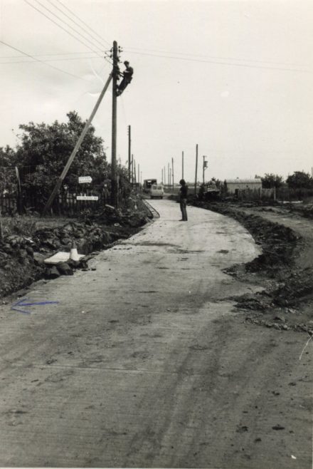
Looking East with Helsingborg Road (now called Sanders) on the left and the Baptist Mission on the right.
Today Somnes Avenue runs from the Waterside Roundabout to the Dovervelt Roundabout.
Before the building of the road as we know it today it was just a short road connecting Zyder Road with Mappel Avenue. As you will see in the map further down the page.
At the same time the road was done electricity was brought to the area.
We do not know the dates of these photos but going by the vehicles it was probably the 60s.
Does anyone remember the road being built? Please comment below.

Close up of the sign from the previous picture
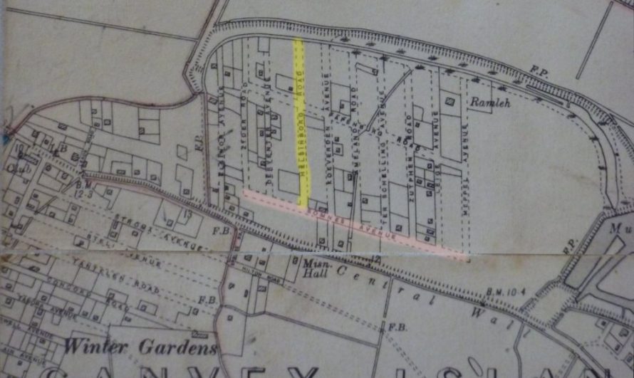
1930s map showing location of Somnes Ave (pink) and Helsingborg Rd (yellow)
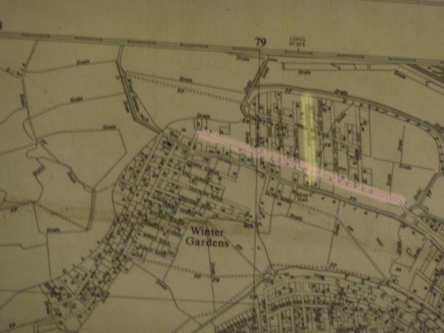
Mid 50s map showing Helsingborg and Somnes
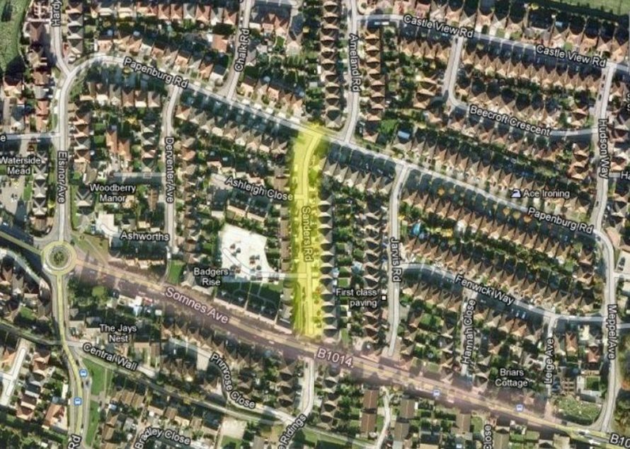
Google map showing same location today


Comments about this page
I don’t understand how the original Somnes Ave was isolated from any other roads, how did people with transport get there? I thought it was connected to the east.
Apparently not in the 1930s. Not many people had transport then Dave so I suppose it was not a problem.
Reading your comments has made me realise how far Canvey has come. When I grew up on Canvey very few roads were concrete, the majority were grass. Winter Gardens, Leigh Beck, where I lived, and the Tewkes Creek areas were all grass. Very few people owned cars and the only time anything with an engine came anywhere near us was the coal lorry which could only get so far and the the coalman would carry the sacks the rest of the way.
Somnes Ave was a gravel track, from Liege Avenue eastwards to where Climmen Road is now, then turned northwards then east into Wittem Road. The new road takes a different route from the existing road, from Castle View School it goes across into Central Wall Road which was originally called Central Wall Path. This information was given to me by my wife Sylvia who lived in Ameland Road in the 50s & early 60s. I’m not sure when the new road was built, I think it was in the late 60s
Thanks Mike that’s very precise. My map from a 1960 Captivating Canvey shows just Climmen and Buyl Rd to it’s west, the end of Somnes Ave is unmarked. The cinder tracks were put in after the Flood, I think they did just Helsingborg, Elsinore and Papenburg in ’60 Acres’ the rest remained as Maureen says just grass tracks. In fact those cinder roads were even worse, after a couple of years they were so pot-holed they were virtually impassable. In those days the large sluice and deep culvert down to the Lake didn’t exist. I guess pre-Flood and pre-War there was a farm track that ran along the same course but was probably was not worthy of mention on 1930 map. The date for the construction of the present Somnes Ave is 1969/70, in fact it was complete and accessable (even the sodium street lights were in place) but it came to an abrupt end somewhere to the east of where the Waterside complex is now. Don’t know why and can’t remember when it was eventually joined to the Waterside roundabout.
Perhaps it was because Canvey Way was still being constructed and Waterside Roundabout had not been finished or even constructed at that point.
I have added a mid 50s map which gives more detail. Unfortunately not a very clear picture. I will try to get another
On the left hand side before the bushes was a bungalow named ‘Northfields’ which is where we lived 1967-1969. Next door looking towards Waterside Farm was a wooden house owned by Mr Owen which I think was called ‘The Cottage’, He kept a beautiful garden with very many Rose bushes. The Bungalow on the right was derelict and horses were kept in the grounds eventually taking over the building too. I believe the Ash road laid after the flood was put down by Hodder and Wiles (Whiles). I remember the pot holes !
I lived off Somnes road,Canvey island from 1958 to 1963.I have tried to find my home which my dad built his self. This was a poultry farm. I think it was Liege ave or Mappel ave, cant remember which. Does anyone remember this house, brick built,built in approx 1958.
I believe Somnes Avenue was completed in 1974.
Add a comment about this page